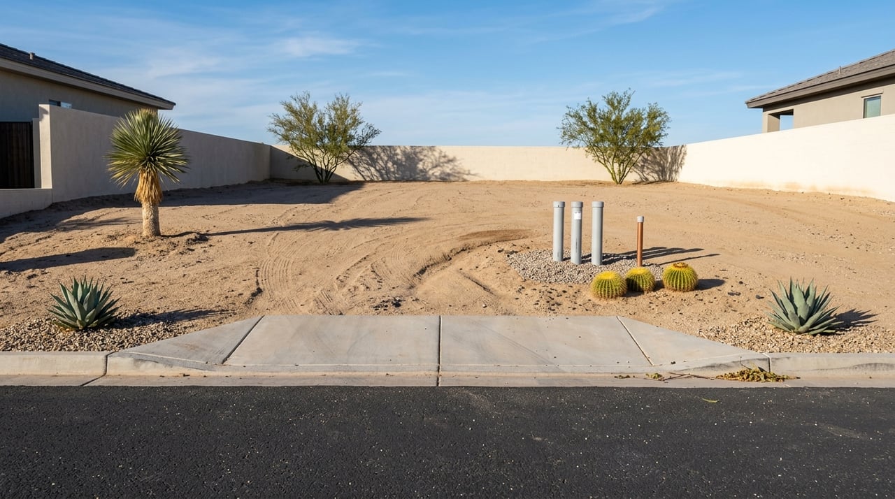
How To Evaluate Land And Lots In Mission Hills
June 25, 2026
June 25, 2026
You can fall in love with a Mission Hills lot in minutes and still miss the details that matter most. If you are thinking about buying land here, the real question is not only how much acreage you are getting, but how the parcel actually functions under Henderson’s rules and physical constraints. A smart review can help you avoid expensive surprises and focus on lots that truly support your vision. Let’s dive in.
Mission Hills is best understood through Henderson’s Rural Neighborhood Preservation framework. The city identifies a Mission Neighborhood area within that program, which is intended to preserve rural character, limit more intense nearby non-residential development, and maintain neighborhood identity.
That matters because Mission Hills should not be judged like a standard suburban subdivision. Henderson’s planning documents describe rural neighborhoods as places oriented toward open-space living, custom-built homes, equestrian uses, fewer public street lights and sidewalks, and no mandatory CC&Rs or homeowners associations.
For you as a buyer, that changes the evaluation process. Before you focus on price per acre, you want to understand what kind of estate environment the parcel is legally and physically set up to support.
Henderson’s plan documents identify two relevant land-use intensities for these rural preservation areas:
These intensity ranges give you a better sense of how low-density the surrounding environment is intended to remain. If privacy, open space, detached guest space, or room for larger accessory improvements are part of your long-term vision, this context is important from day one.
Once you understand the rural framework, the next step is to confirm the parcel’s zoning and land-use designation. Henderson’s low-density residential zoning family includes RS-1, RS-2, RS-4, RS-6, and RS-8, with densities of 1, 2, 4, 6, and 8 units per gross acre respectively.
The minimum lot areas in the current code are:
For many Mission Hills buyers looking at premium land, the lowest-density districts are often the most relevant. Henderson describes RS-1 and RS-2 as large-lot single-family detached districts compatible with the desert landscape.
In RS-1, the current code shows:
In RS-2, the current code shows:
These numbers may look technical, but they directly affect what you can build and how comfortably it fits on the site. Two lots with similar square footage can offer very different design flexibility depending on width, depth, orientation, and setbacks.
A large lot on paper is not always a large lot in practice. Henderson’s development code defines the front lot line as the lot line abutting the street or right-of-way to which the lot has access and is oriented for development. On a corner lot, the shorter frontage is treated as the front line.
That detail can affect your building envelope more than many buyers expect. If the parcel is corner-oriented or has unusual geometry, the location of the front lot line may reduce where the home, driveway, or outdoor features can realistically go.
For a custom estate, lot geometry often matters as much as acreage. A wider parcel usually gives you more flexibility to place the main residence, pool, guest space, garages, and outdoor living areas without overloading the site with driveway and hardscape.
A narrower parcel can still work, but your margin gets smaller quickly. Once setbacks, circulation, and outdoor improvements are drawn in, the site can feel much tighter than the listing photos suggest.
One of the most overlooked issues in land evaluation is lot coverage. Henderson defines lot coverage broadly, including principal buildings, accessory structures, patios, decks, driveways, and other impervious surfaces.
That means your usable area is not just about the footprint of the house. The driveway, detached structures, hardscape, and outdoor living features all count toward how the lot functions.
If your goals include features like a guest casita, larger garage space, RV storage, or extensive outdoor entertaining areas, this is a key part of the review. A parcel that looks generous online may become far less flexible once all of those pieces are placed within the legal envelope.
In Mission Hills land deals, utilities can change the true cost of a parcel more than the listing price does. Henderson provides water and sewer service, with drinking water supplied through the Southern Nevada Water Authority and delivered by the city.
The first question is not simply whether water and sewer are nearby. You need to confirm whether the parcel is already stubbed, whether mains must be extended, and how the timing of connection may affect your budget and build schedule.
Henderson states that new developments located within 400 feet of the nearest city water main must connect to the city water system. The city also states that the builder is required to extend public water and sewer mains to the parcel and across the full frontage of the lot or lots.
The same utility guidance says that if a parcel is serviced by Colorado River water provided by the city, it must also connect to the city sewer system regardless of distance. It also notes that existing septic customers must connect to city sewer if they need a new septic permit.
This is one of the biggest hidden-cost areas in vacant land. A parcel with clean utility access can be much more attractive than a cheaper lot that requires significant off-site extensions.
Outdoor living is a major part of the Mission Hills lifestyle, but landscape rules still shape what is realistic. Henderson says new turf in residential front yards, common areas, and medians is prohibited.
The city also limits turf in side and rear yards to 50% or less of the landscaped area. In addition, homes with existing desert landscaping may not be allowed to replace it with turf.
For you, this means the most successful plans often lean into desert landscaping, shade structures, and water-smart planting rather than a traditional lawn-heavy layout. It is better to understand that early than to build a design around assumptions that do not fit current local rules.
Even in a desert setting, flood review is essential. Henderson says a floodplain development permit is required for development in the city’s special flood hazard areas, and the city notes that intense summer thunderstorms can still create flooding.
Before you treat any Mission Hills parcel as straightforwardly build-ready, verify its flood status using the city’s flood resources and FEMA map tools. That step can help you avoid costly redesigns or permit delays later.
If the parcel is near hills, native desert, or a steeper edge condition, fire-related overlays may come into play. Henderson says hillside-development fire requirements are addressed in the development code, and the city also maintains a Wildland-Urban Interface code and map.
This is why some lots can appear simple in marketing remarks but require more review once design begins. If the site is affected by hillside or WUI considerations, those constraints should be part of your decision before you go under contract.
Recorded easements can dramatically reduce the truly usable part of a lot. Henderson’s code definitions require utility easements along lot lines, and the city states that storm sewer easements generally must be at least 20 feet wide unless waived.
The city also states that emergency access easements must be at least 24 feet wide and may not be divided by lot lines. If your driveway, wall layout, or detached structure plan conflicts with those easements, the parcel may not support your intended design as easily as expected.
Street access should be verified just as carefully as zoning. Henderson’s Street Directory identifies official street names and whether a street is public or private.
That can help you confirm whether the parcel has straightforward public-road access or whether a private-road or internal-access arrangement may need additional review. In land purchases, access details are not small details. They shape both usability and cost.
A serious Mission Hills land review usually starts with four maps and one code check:
The city’s Street Address Map Atlas is especially useful because each map covers half a section and includes parcels, streets, addresses, building footprints, and subdivision boundaries. Henderson also notes that its current development code update was adopted on April 19, 2022, so current map layers and current code tables should be used instead of relying on older listing remarks alone.
When you evaluate land in Mission Hills, make sure you can answer these questions clearly:
The best parcels for a custom estate usually combine low-density zoning, enough frontage for a workable building envelope, clean utility access, and minimal easement conflict. Smaller, narrower, corner-oriented, or easement-burdened parcels can still be attractive, but they require a much more deliberate site plan.
If you want a clear, private path to buying land in Mission Hills, working with an advisor who understands both lot selection and the build process can save you time and reduce risk. To explore available land, custom build potential, or a private tour, connect with Cynthia Lauren Huff.
Stay up to date on the latest real estate trends.
Get assistance in determining the current property value, crafting a competitive offer, writing and negotiating a contract, and much more. Contact me today.